Pennards since 2007
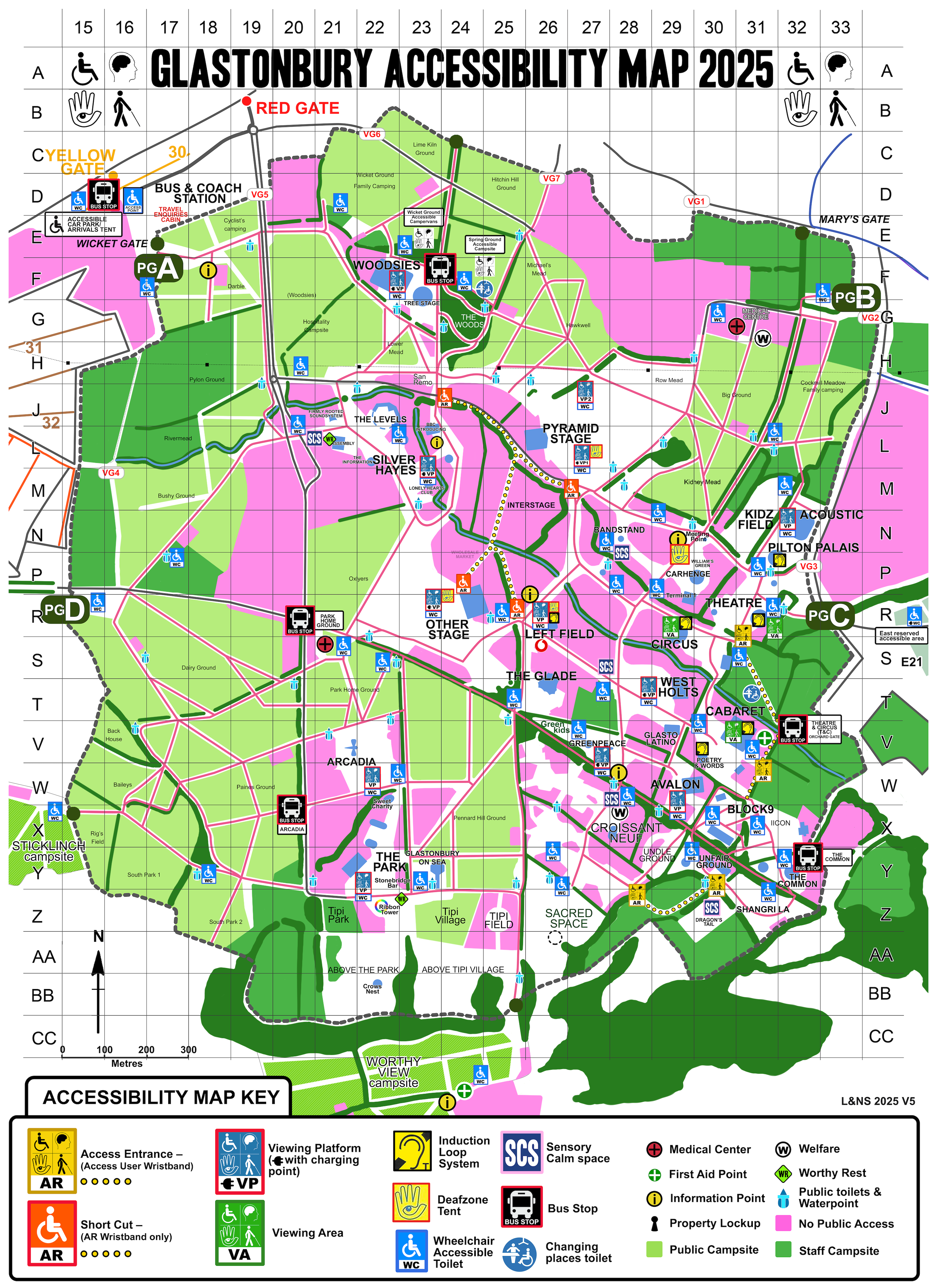
Glastonbury 2025 Access Map (Camp Triangle Version) - Image (6.8 MB) - Camp Triangle version of the Glastonbury 2025 Access Map that shows access points such as, Viewing Platforms, Shortcuts, Accessible Toilets, Medical Centres, Access Entrances, Bus Stops. Also includes Camp Triangle Location.
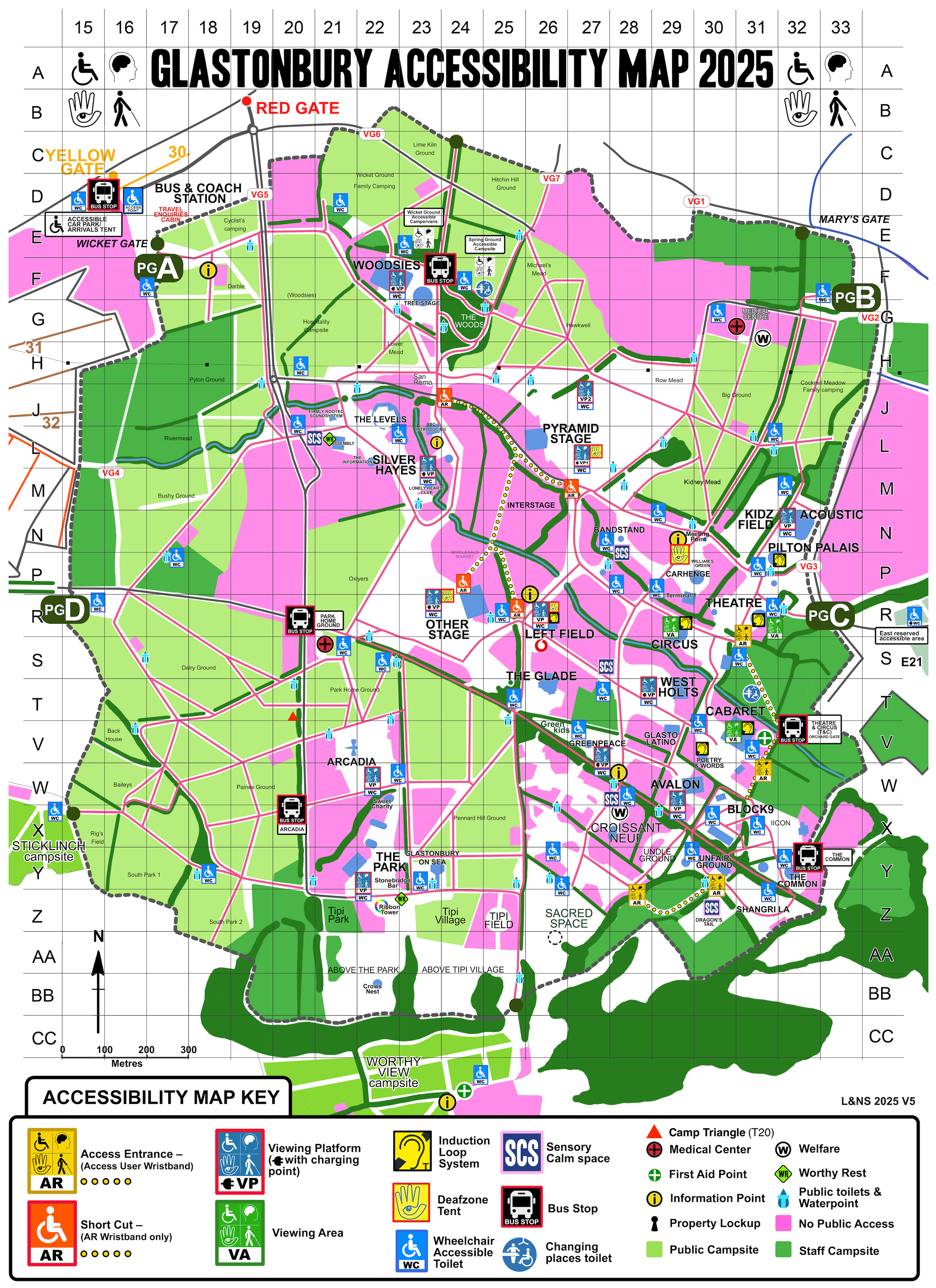
Glastonbury 2025 Access Map - Image (6.7 MB) - Access Map that shows access points such as, Viewing Platforms, Shortcuts, Accessible Toilets, Medical Centres, Access Entrances, Bus Stops
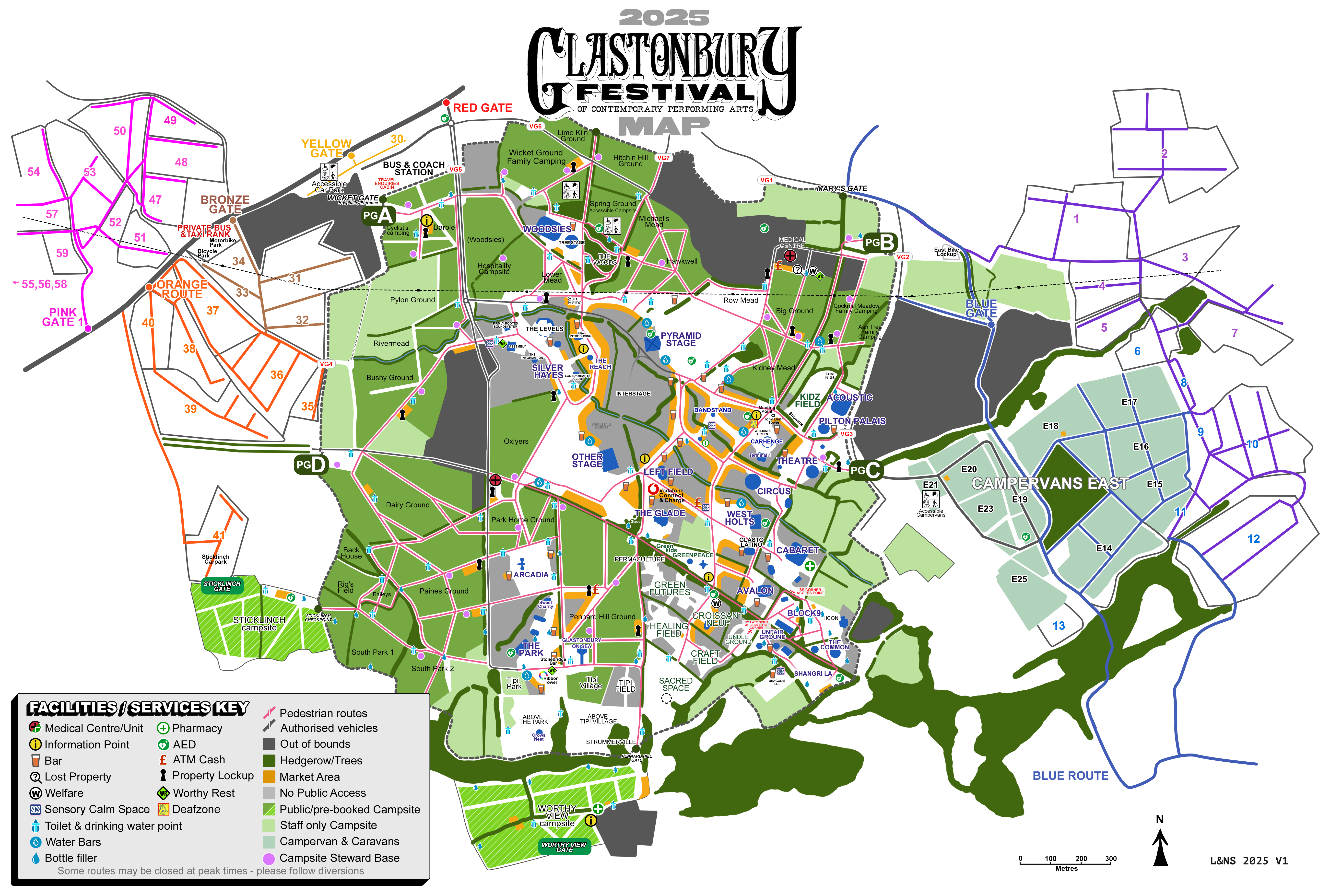
Glastonbury 2025 Map V1 with Camp Triangle - Image (5.2 MB) - This is the official Glastonbury 2025 map shared on their website. This version shows the location of Camp Triangle.
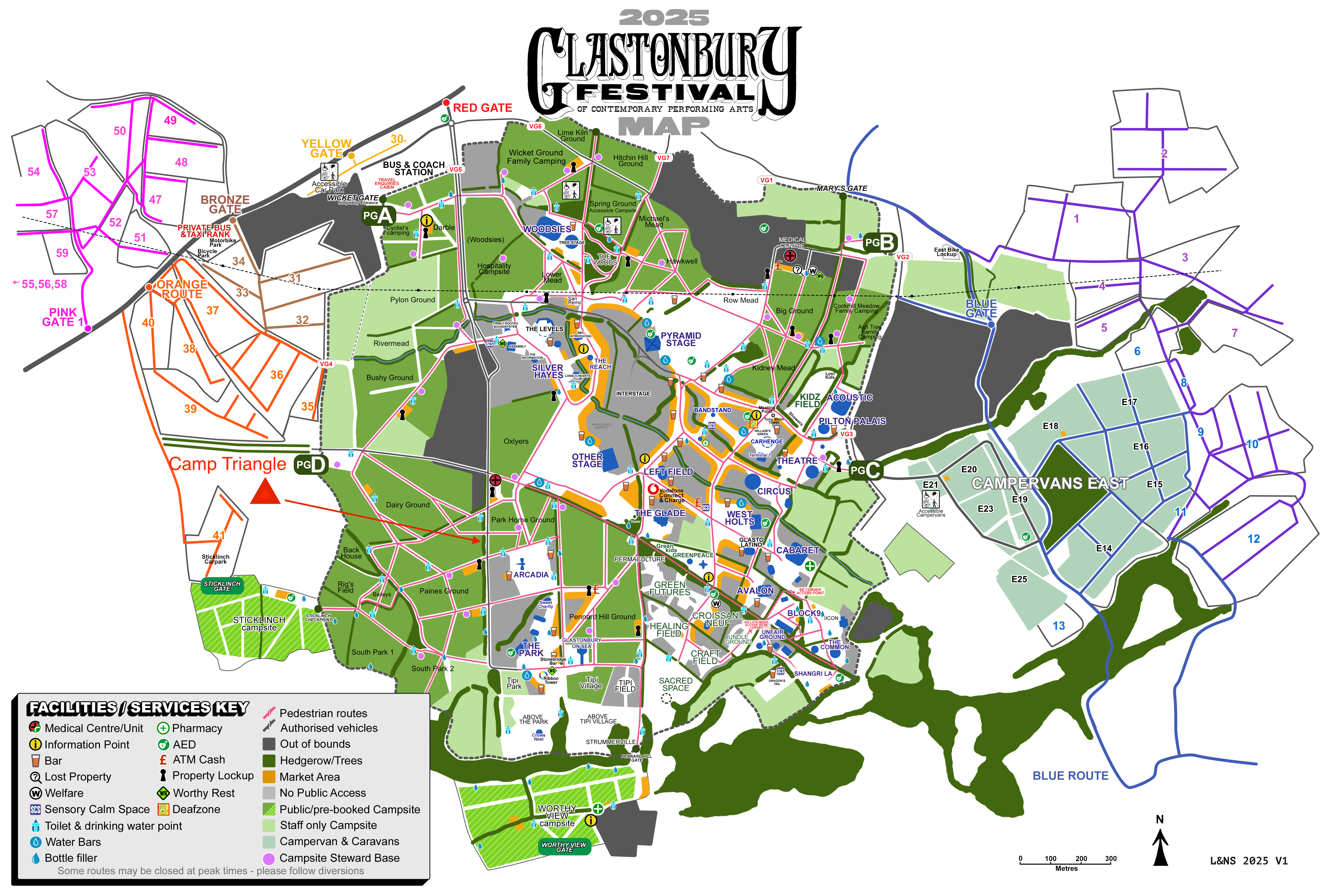
Glastonbury 2025 Map V1 - Image (4.7 MB) - This is the official Glastonbury 2025 map shared on their website
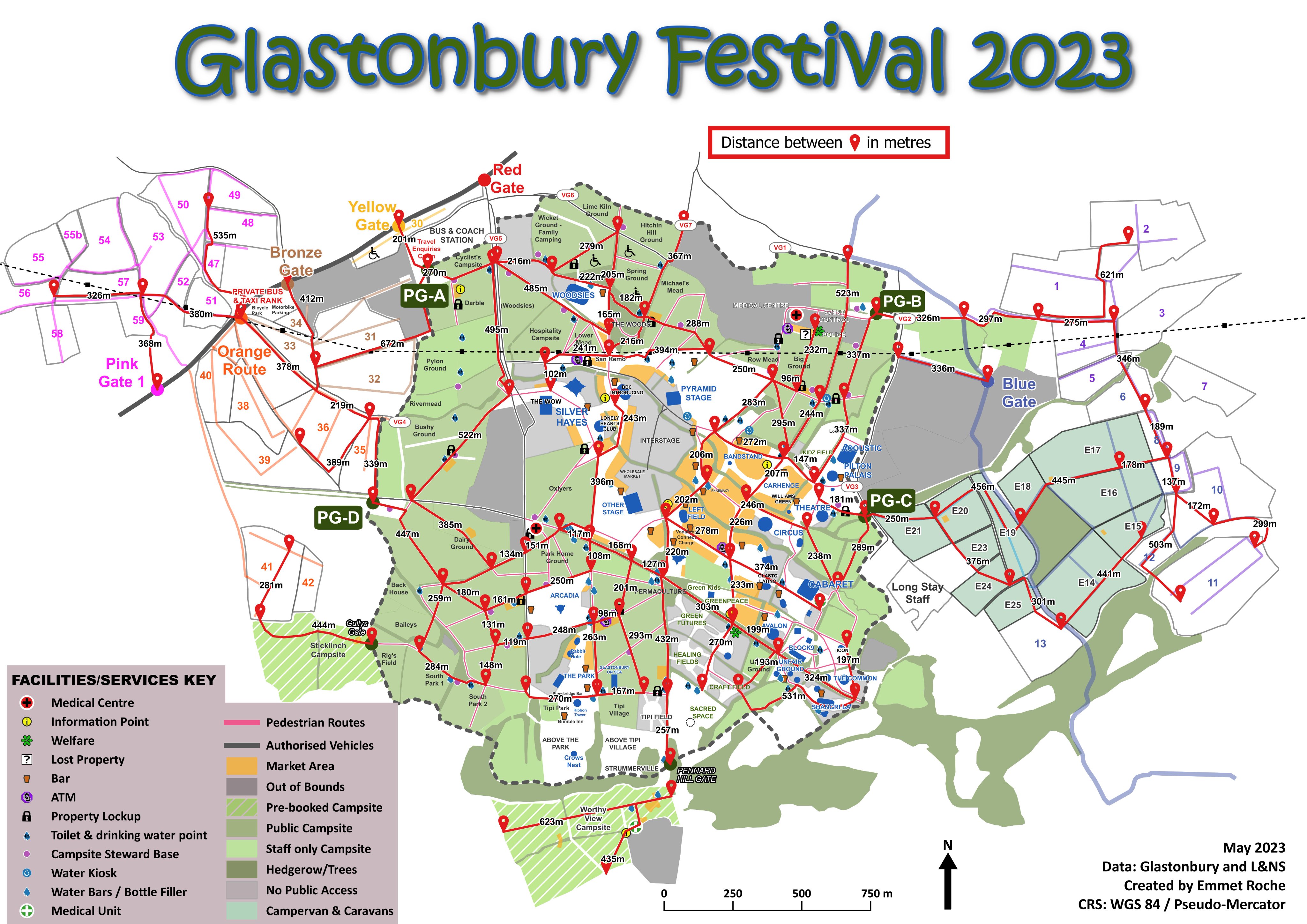
Glastonbury 2023 distances map - Image (1.3 MB) - A map of glastonbury festival showing distances in meters
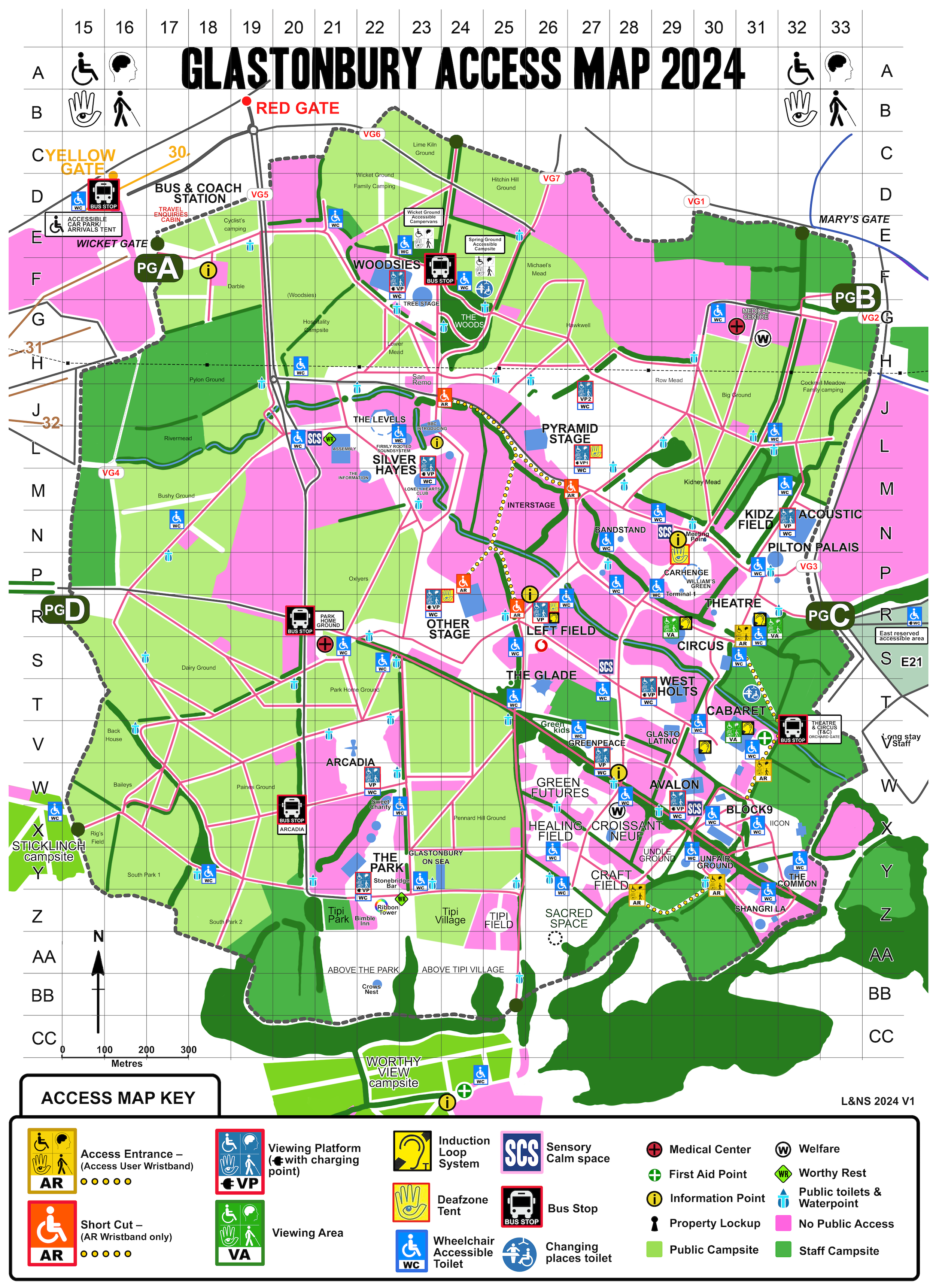
Glastonbury 2024 Access Map - Image (5.4 MB) - Access map for Glastonbury 2024, showing all the disability points on the site.
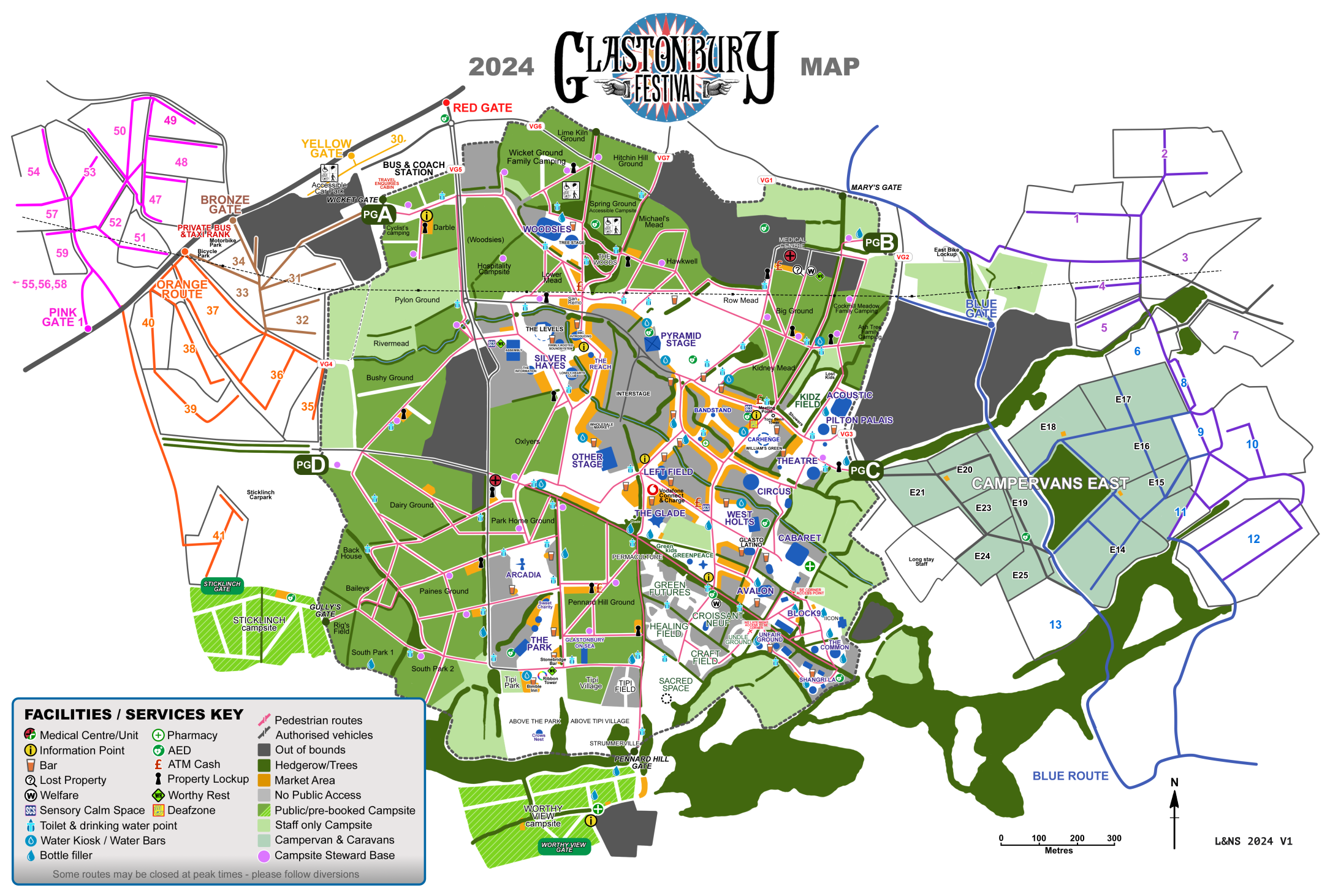
Gastonbury 2024 Map V1 - Image (1.7 MB) - New 2024 version of the Glastonbury map showing Arcadia Dragonfly and Tree Stage
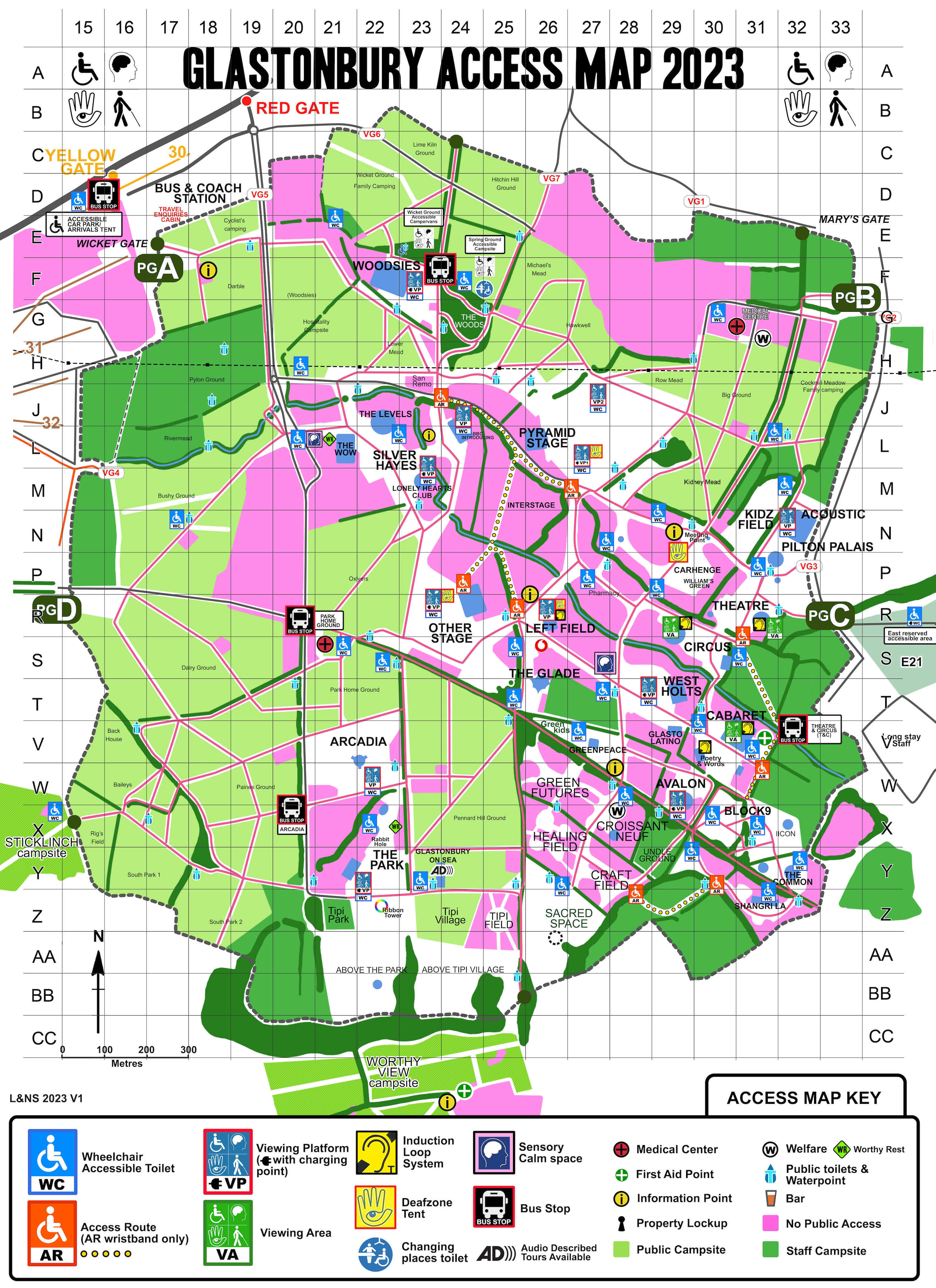
Glastonbury 2023 Access Map - Image (6.3 MB) - Access map for Glastonbury 2023, showing all the disability points on the site.
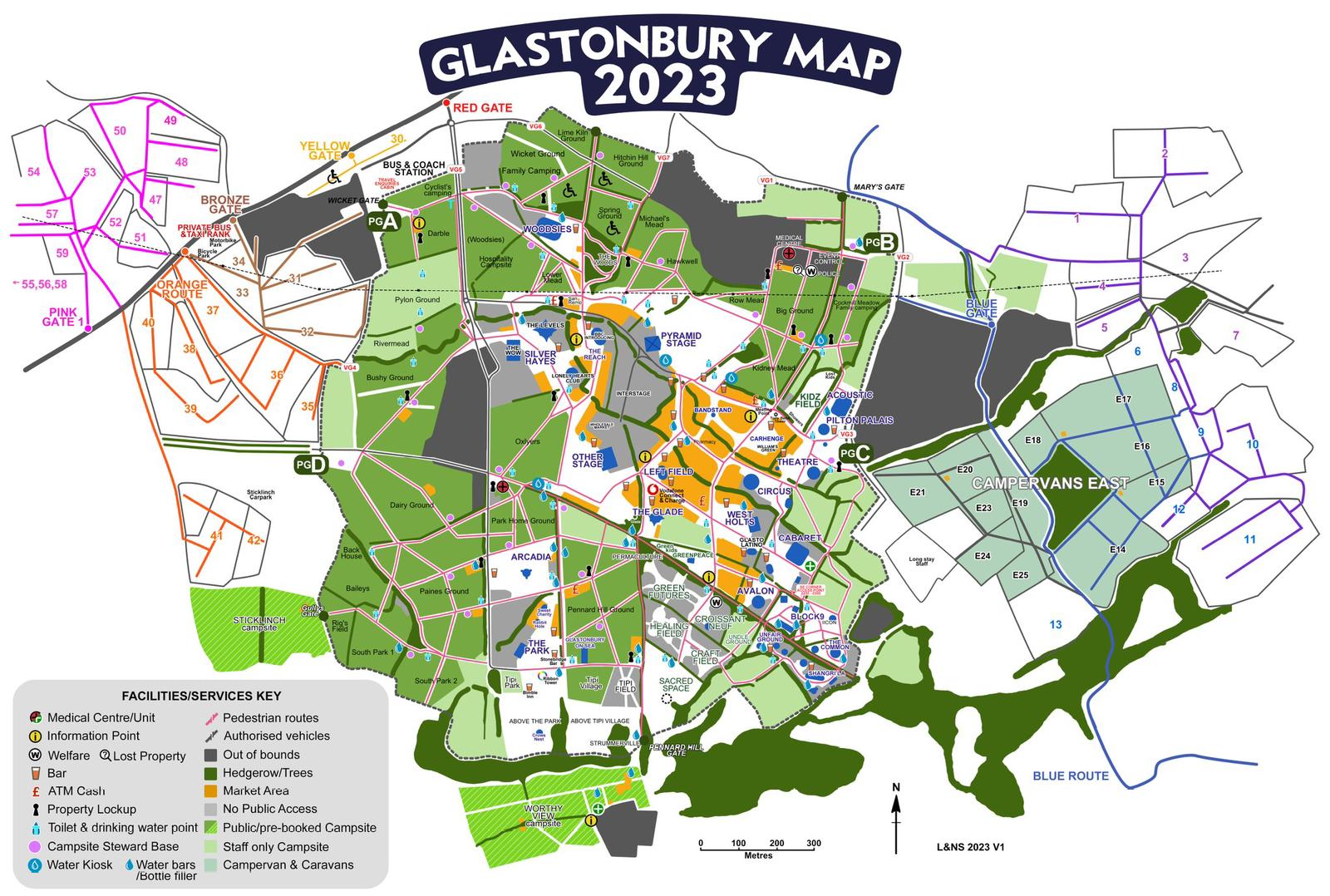
Glastonbury 2023 Map V1 - Image (279.9 KB) - This is forth iteration of the 2023 map, released in May, I'd fully expect this to change. It shows Car Henge and changes to site.
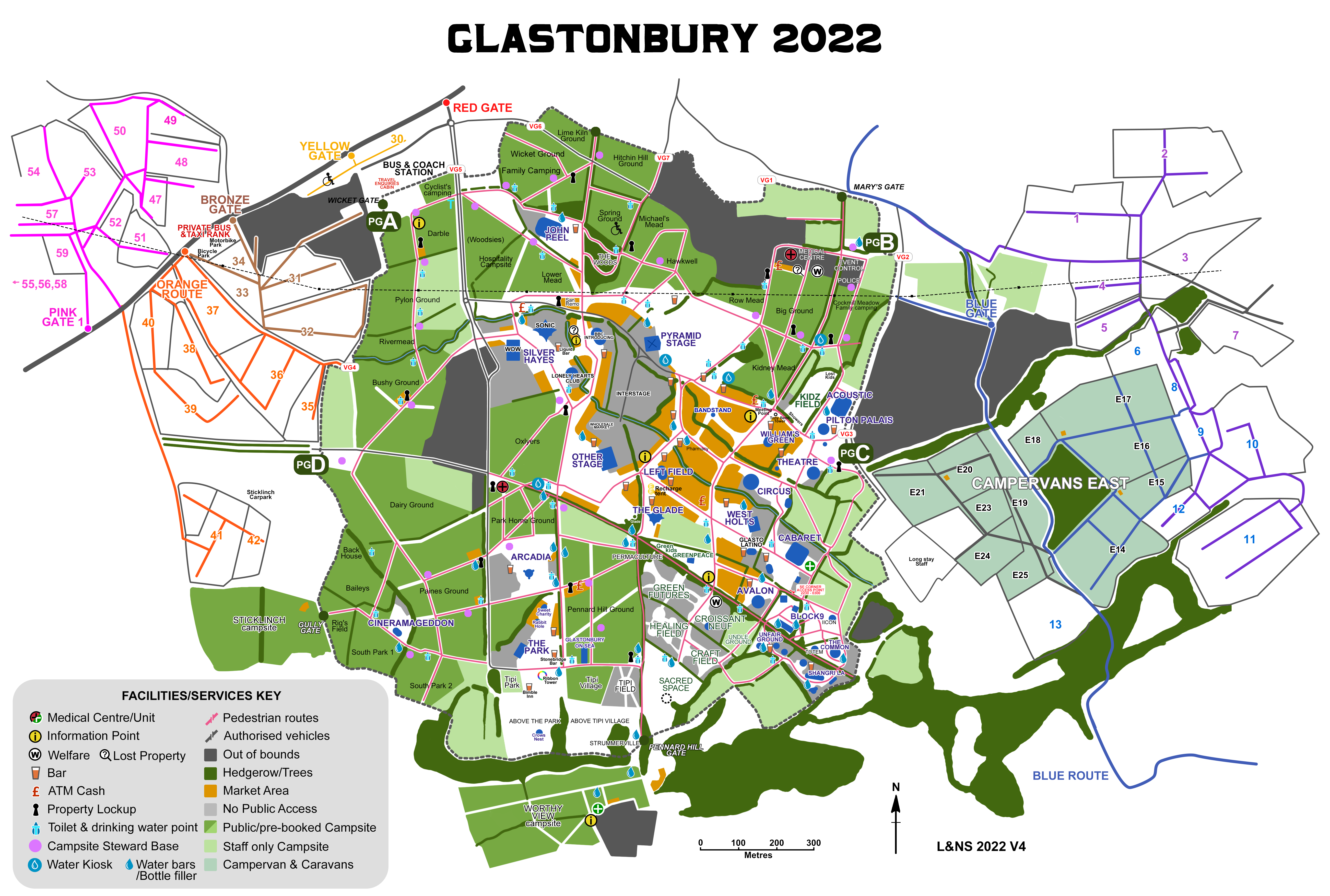
Glastonbury 2022 Map v4 - Image (4.1 MB) - This is forth iteration of the 2022 map, released in May, I'd fully expect this to change. It shows Sticklinch and changes to site.
Gazebo Instructions - PDF (8.6 MB) - Instructions for erecting the new Camp Triangle Gazebos, it also has parts list starting page 49
Glastonbury 2022 Map v1.1 - Image (3.9 MB) - This is second iteration of the 2022 map, released in May, I'd fully expect this to change. It shows Sticklinch and changes to site.
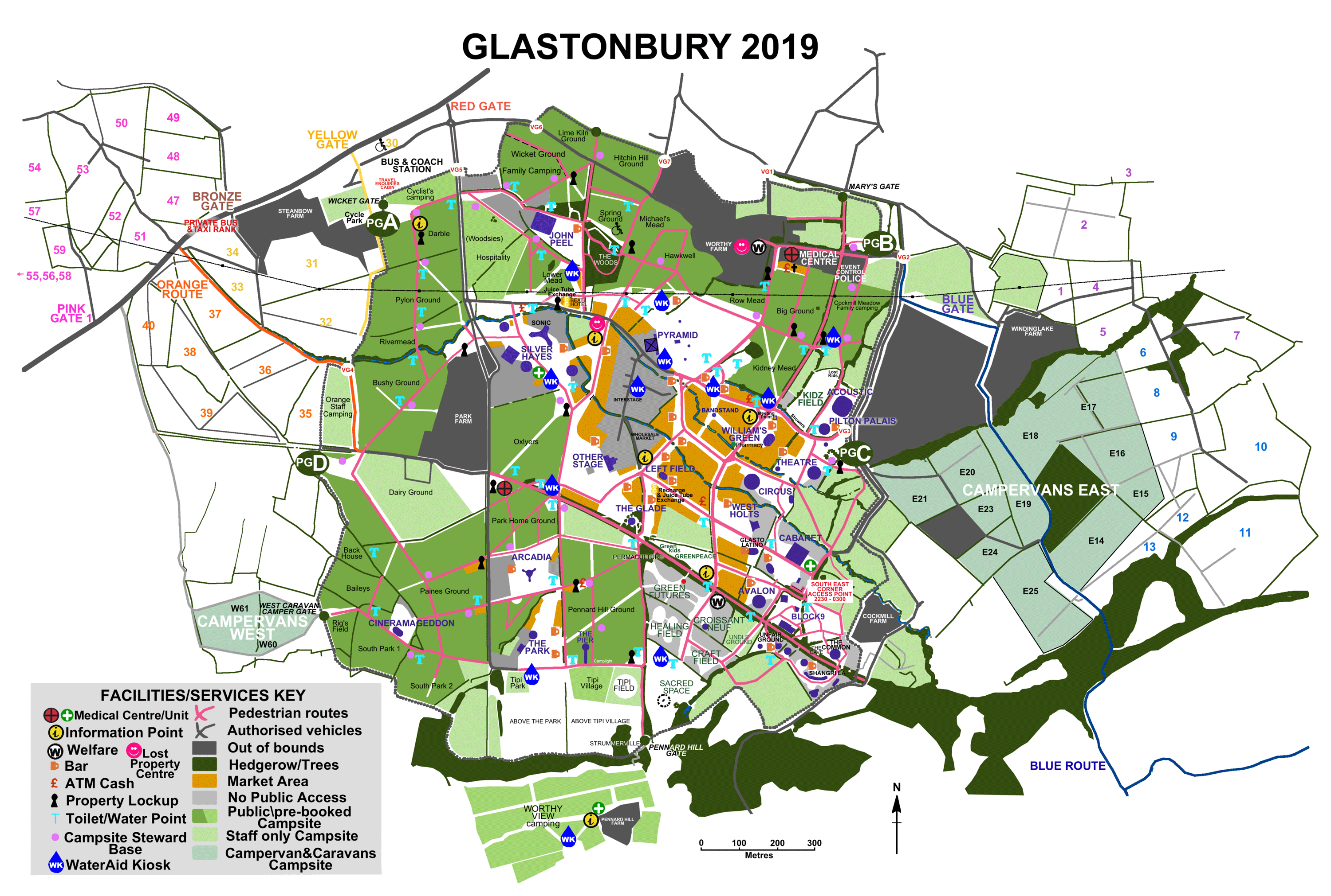
Glastonbury 2019 Map A3 - PDF (2.6 MB) - Glastonbury 2019 A3 Map with Grid
Glastonbury 2019 Map v1 - Image (772.6 KB) - This is a very early version of the 2019 map, released in April, I'd fully expect this to change. Although it shows the location of the Pier.
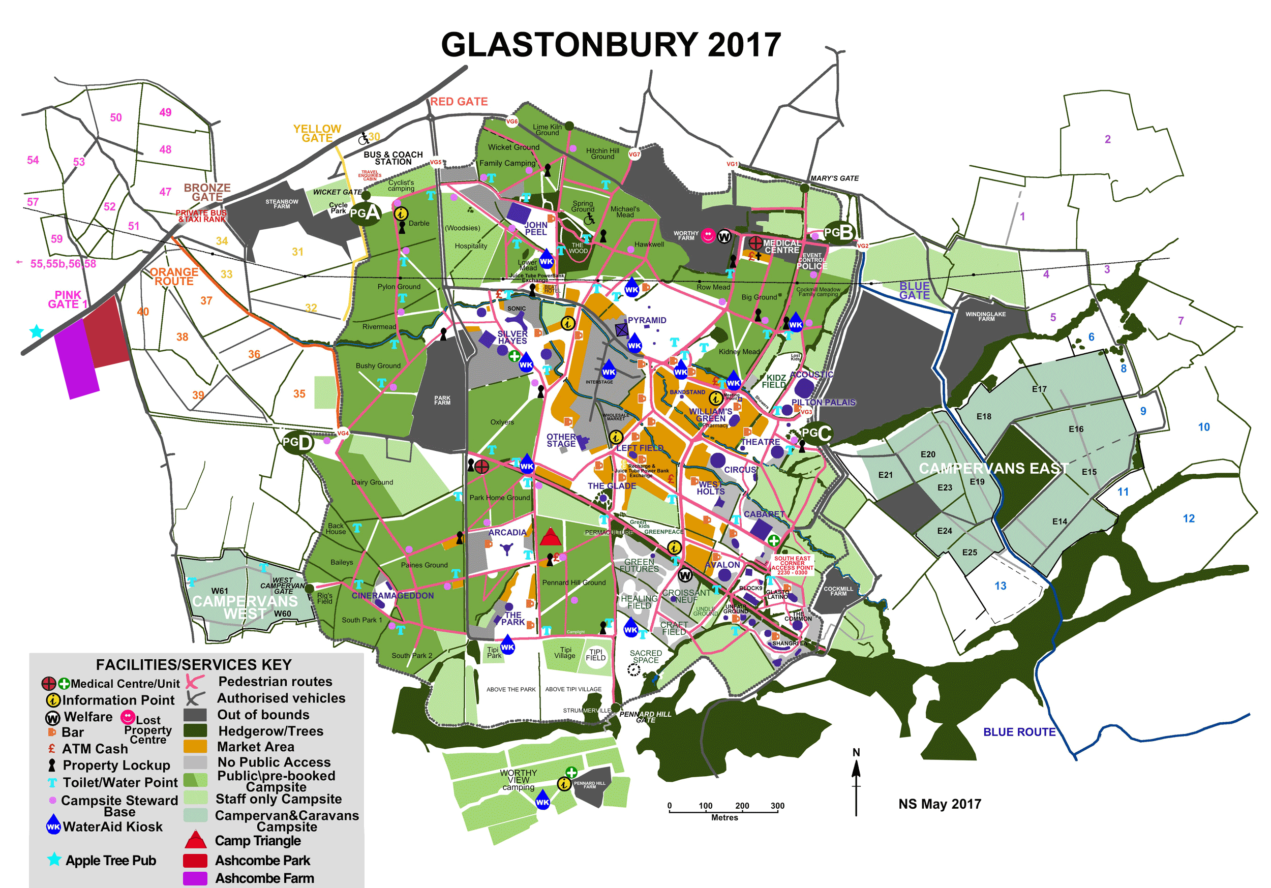
Camp Triangle Glastonbury 2017 Map - Image (2.3 MB) - The 2017 version of the site map, this has Camp Triangle marked on it with a red triangle. Including Ashcombe Farm, Park and the Apple Tree.
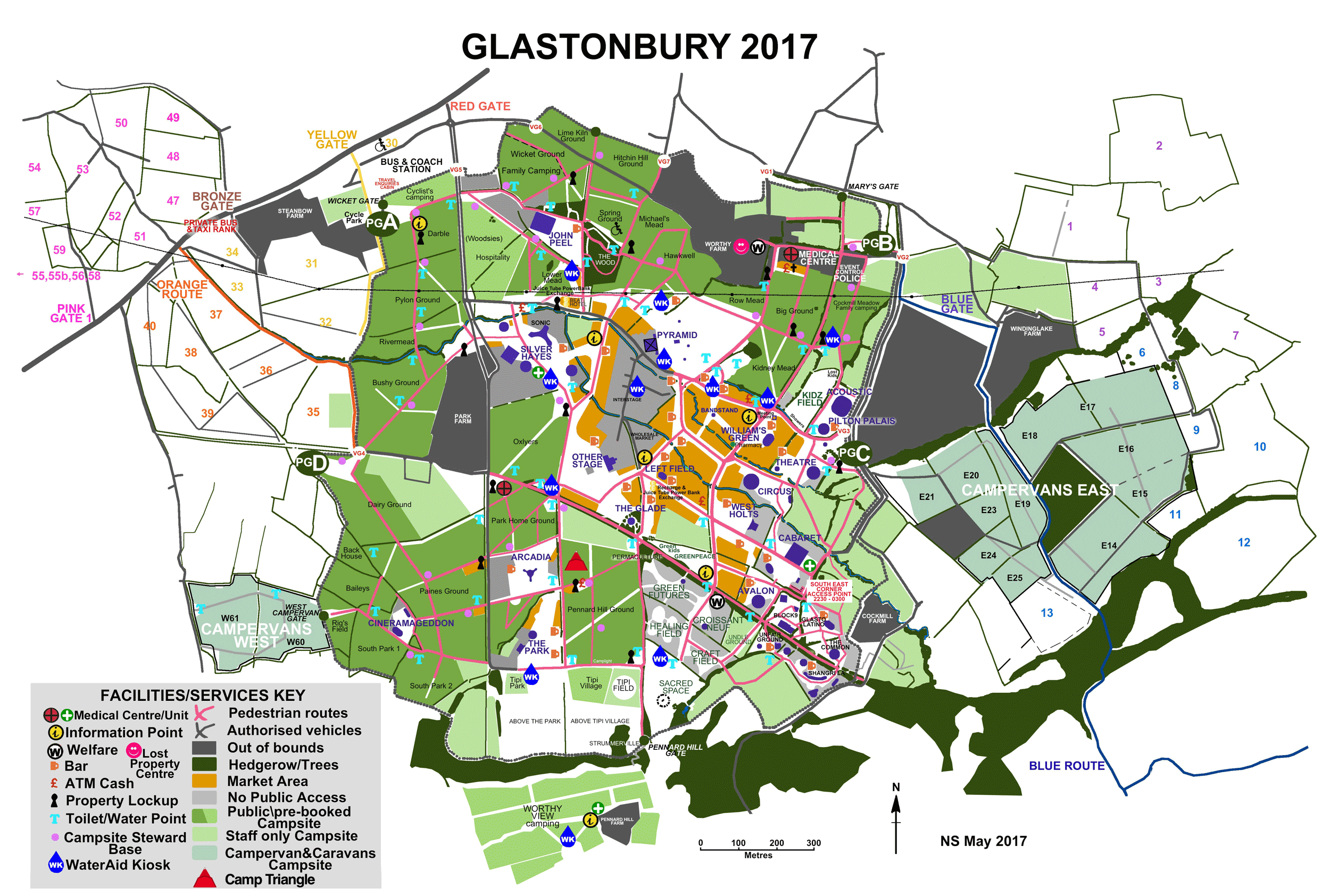
Glastonbury 2017 Map - Image (2.3 MB) - The 2017 version of the site map, this has Camp Triangle marked on it with a red triangle.
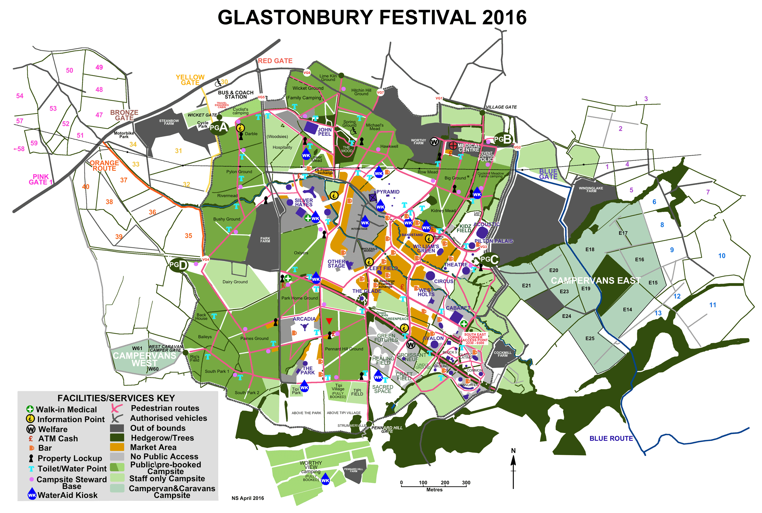
Glastonbury Map 2016 - Image (1.4 MB) - The 2016 version of the site map, this has Camp Triangle marked on it with a red triangle.
Shepton Mallet to Glastonbury Bus Times - PDF (28.2 KB) - This is the timetable for the 669, which stops outside the Apple Tree Inn
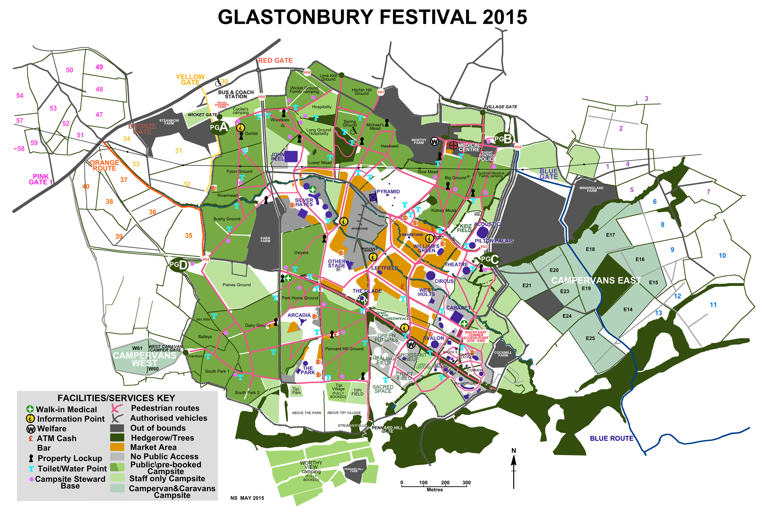
Glastonbury 2015 Map - Image (578.5 KB) - 2015 Glastonbury Site Map
Glastonbury Weather Infographic 2014 - Image (1.3 MB) - In 2013 the Met Office created an info-graphic about the weather over the years at Glastonbury Festiva;
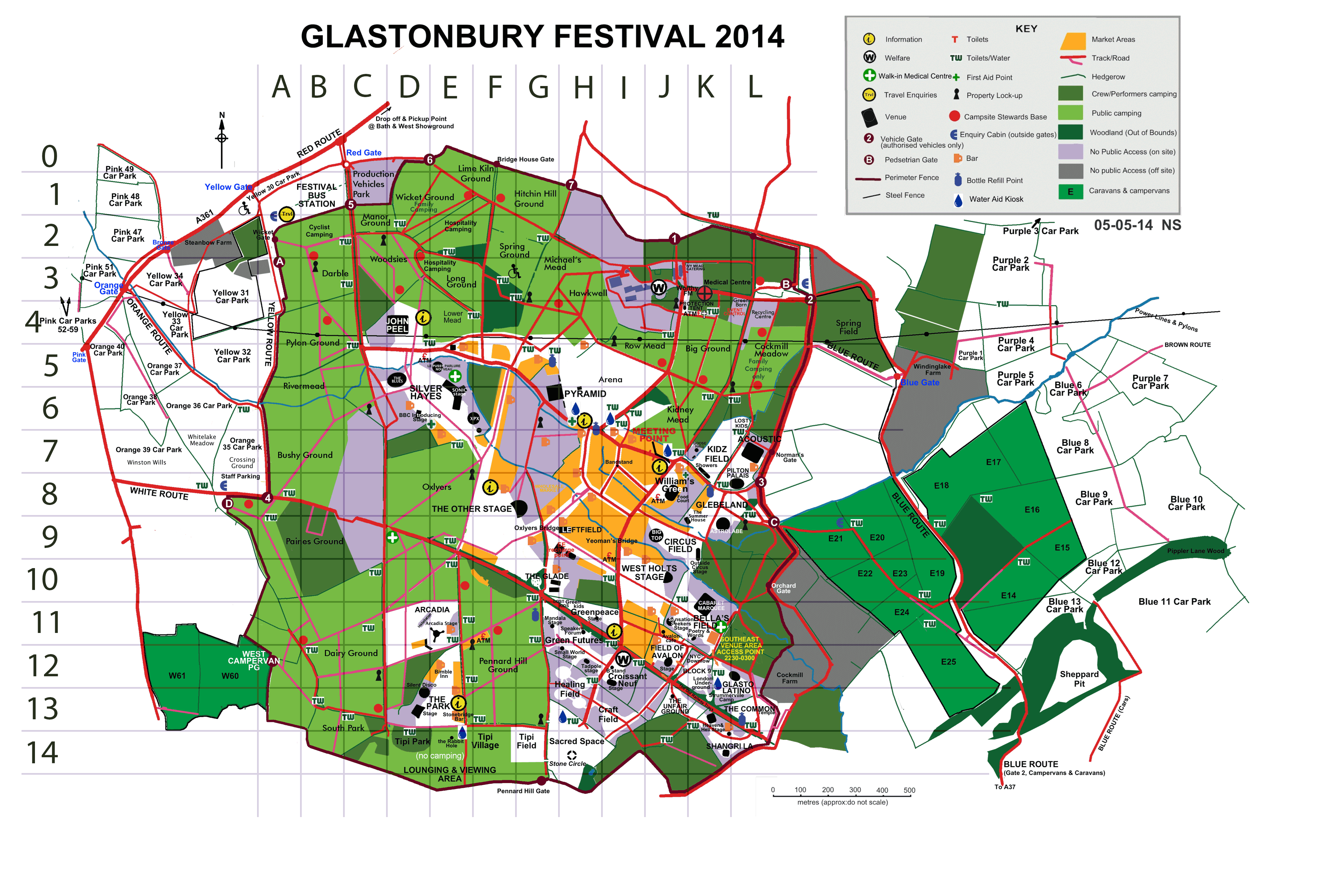
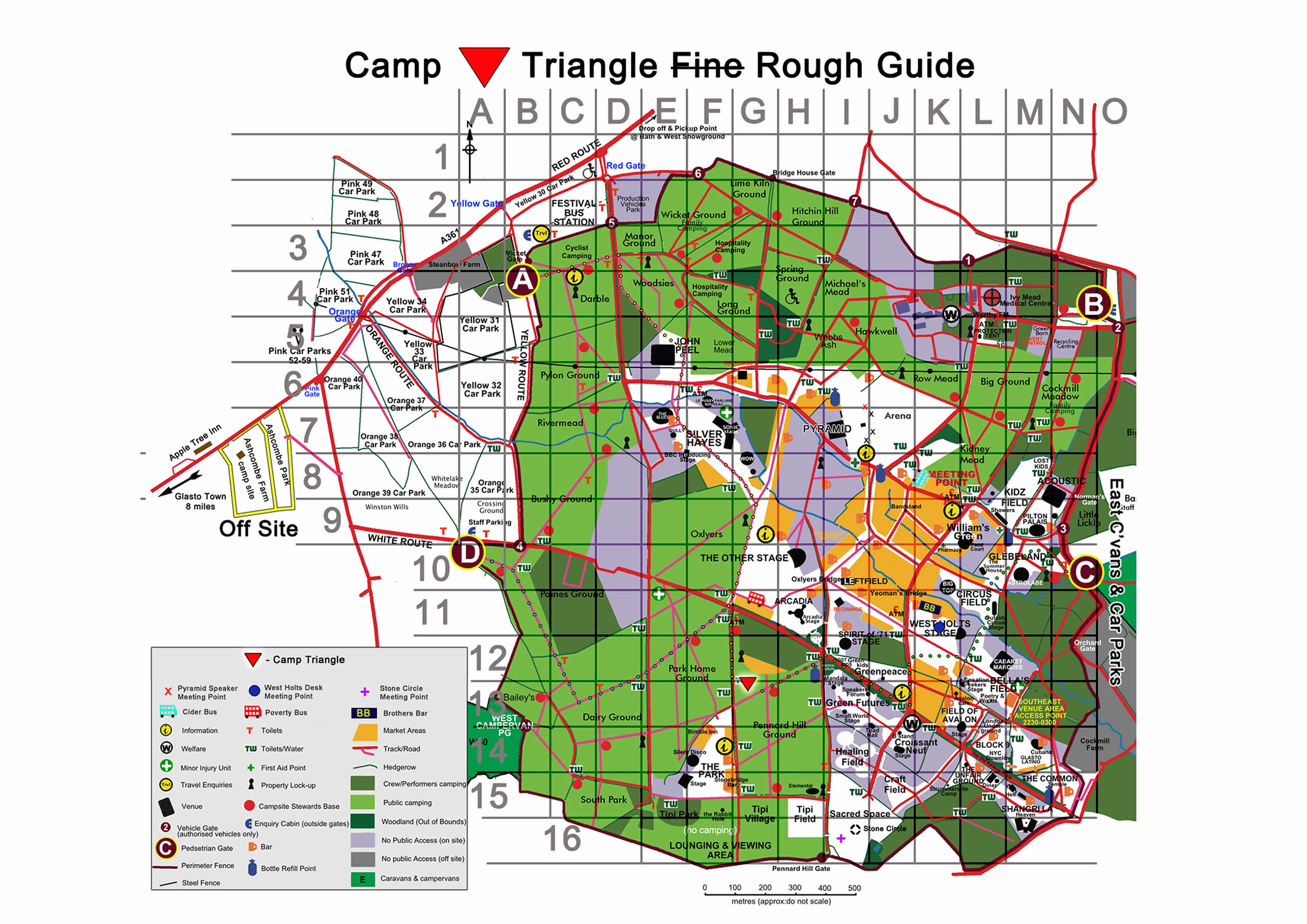
Glastonbury Map 2014 (with Grid) - Image (1.3 MB) - Camp Triangle's very own Glastonbury Festival 2014 Fine Guide with Grid
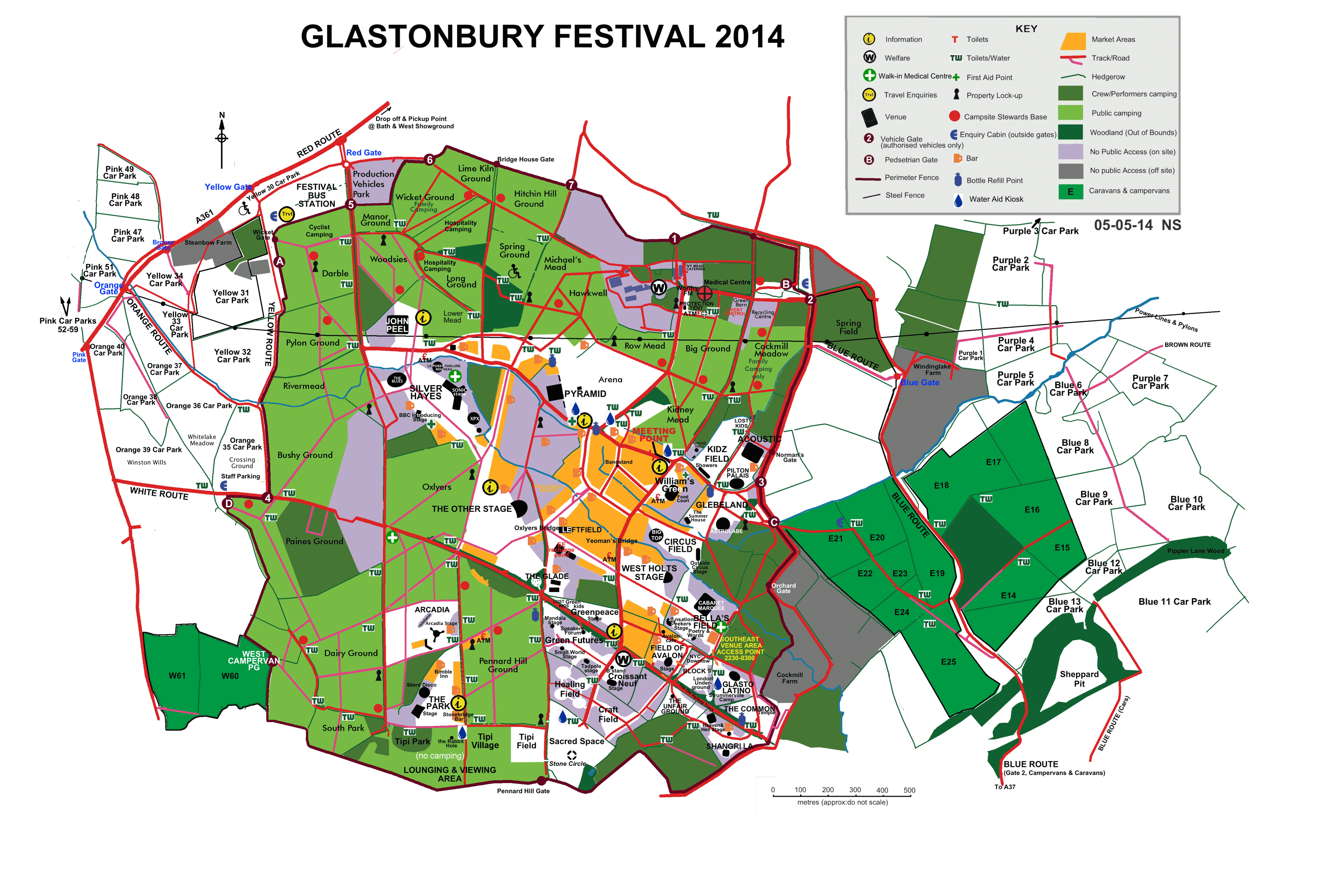
Glastonbury Map 2014 - Image (785.0 KB) - Official Glastonbury Festival 2014 Fine Guide (version 1)
Camp Triangle Glastonbury Map 2013 (with Grid) - Image (728.3 KB) - Camp Triangle's very own version of the Glastonbury 2013 site map, but this time with a grid to help you find things
Camp Triangle Site Map 2013 - Image (634.3 KB) - Camp Triangle's very own version of the Glastonbury 2013 site map with meeting places and routes marked
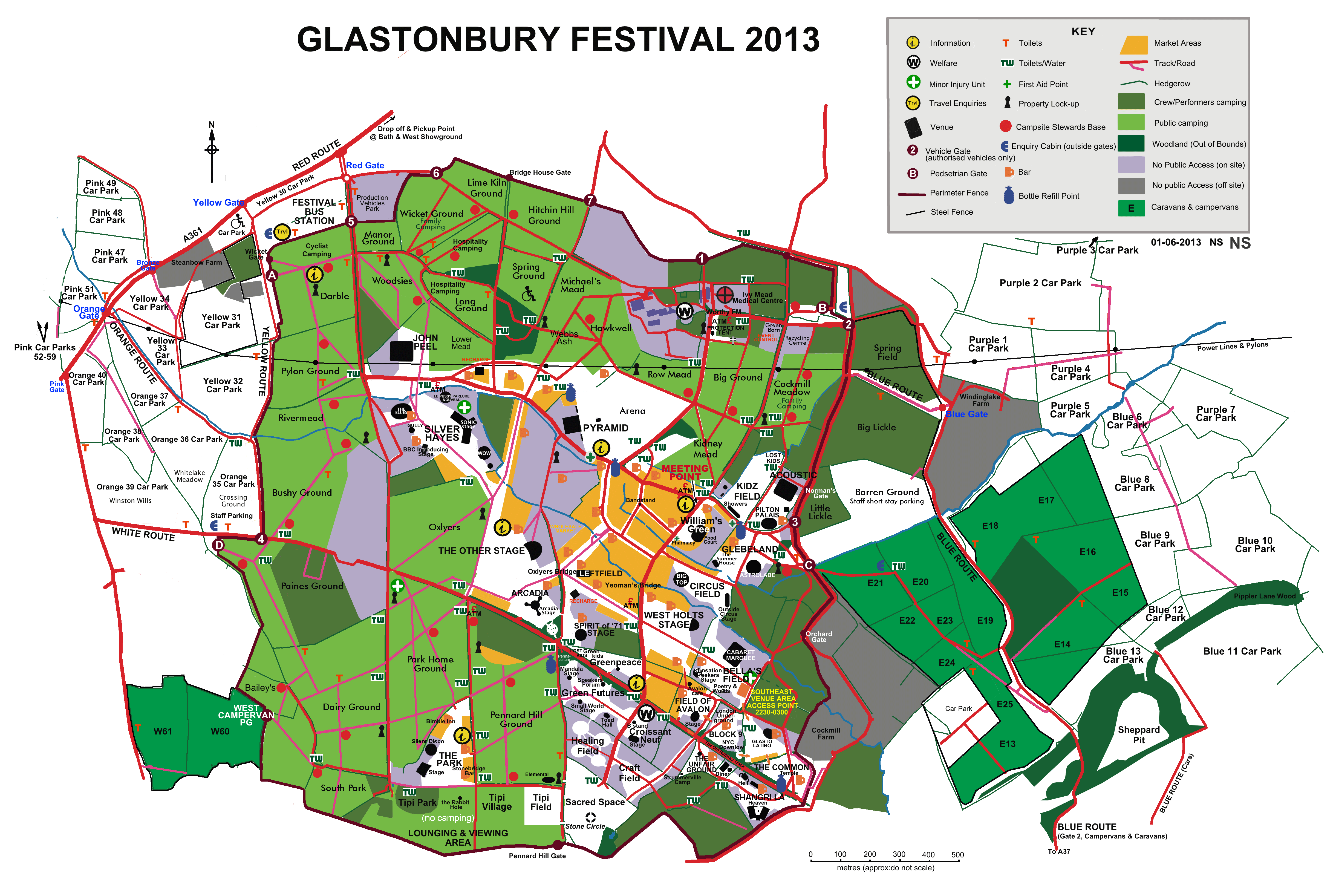
Glastonbury Site Map 2013 - Image (919.8 KB) - Glastonbury Festival 2013 Site Map
A3 Glastonbury 2013 Map - PDF (21.7 MB) - Official 2013 camp information stations map
Glastonbury Fine Guide 2013 - PDF (269.9 KB) - Glastonbury Festival 2013 Fine Guide
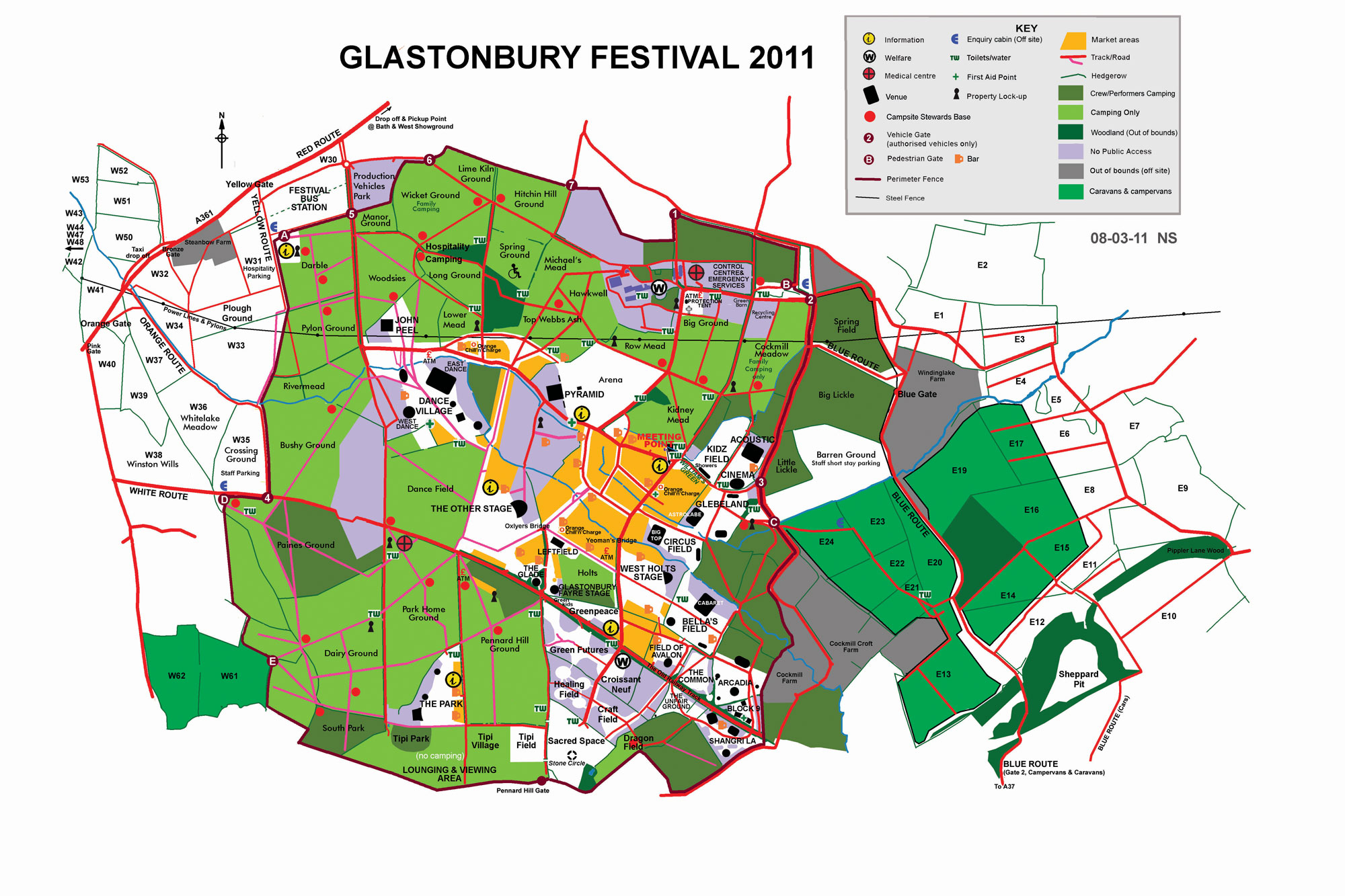
Glastonbury 2011 Map - Image (535.4 KB) - 2011 Glastonbury Site Map
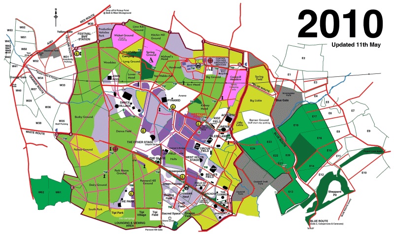
Glastonbury 2010 Map - Image (167.3 KB) - 2010 Glastonbury Site Map
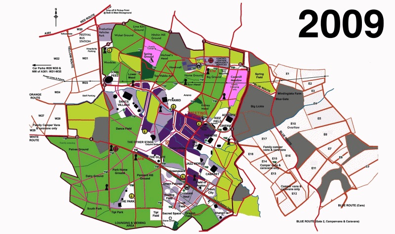
Glastonbury 2009 Map - Image (150.5 KB) - 2009 Glastonbury Site Map
Glastonbury 2008 Map - Image (301.2 KB) - 2008 Glastonbury Site Map
Glastonbury 2007 Map - Image (316.2 KB) - 2007 Glastonbury Site Map